Agadir Melloul Copper and Silver Project
A new discovery in the Western Anti-Atlas
Over 12km of copper-silver mineralisation in outcrop
Grid power, asphalt road and only 3hrs to the commercial port of Agadir
Maiden resource
Phase 1 drilling started in September 2025. The programme consists of 10,000m and is designed to produce a maiden Mineral Resource Estimate (MRE), sufficient to underpin an Initial Mine development. The mostly 100m x 50m drill plan is relatively tight for a maiden programme, maximising geological certainty and shortening the development timeline.
Only 6% of project drilled
The maiden resource will be from about 6% of the Agadir Melloul project area, and so its tonnage will not reflect the project’s excellent potential and ultimate scale.
Dual Strategy
Early cashflow and a large scale resource
In parallel to the Initial Mine development, exploration work and diamond drilling will continue. This will involve drill-testing numerous high quality outcropping copper targets across the project to expand the resource.
This is CMR’s Dual Strategy for Agadir Melloul.
Dual Strategy
Illustrative scenarios - not a valuation forecast.
Drill results
| Hole | Width (m) | Cu (%) | Ag (g/t) | Au (g/t) | From (m) | Notes | ||
|---|---|---|---|---|---|---|---|---|
| BH01 | 5.8 | 1.25 | 19.0 | - | 2.2 | Zone 1 North | ||
| BH04 | 2.5 | 0.85 | 4.0 | - | 1.5 | Zone 1 North | ||
| BH06 | 2.0 | 1.30 | - | - | 16.0 | Zone 1 North | ||
| BH07 | 1.3 | 0.98 | - | - | 16.7 | Zone 1 North | ||
| BH09 | 3.0 | 0.75 | - | - | 10.0 | Zone 1 North | ||
| BH12 | 4.0 | 1.04 | - | - | 2.0 | Zone 1 North | ||
| BH35 | 7.5 | 0.97 | - | - | N/A | Zone 1 North | ||
| Inc. | 6.5 | 1.03 | - | - | N/A | Zone 1 North | ||
| BH36 | 4.7 | 1.48 | - | - | 17.0 | Zone 1 North | ||
| BH38 | 4.7 | 1.03 | - | - | 27.0 | Zone 1 North | ||
| BH43 | 3.0 | 1.10 | - | - | 6.0 | Zone 1 North | ||
| BH45 | 1.6 | 1.10 | - | - | 6.0 | Zone 1 North | ||
| and | 4.0 | 0.77 | - | - | 16.4 | Zone 1 North | ||
| inc. | 2.0 | 1.05 | - | - | 16.4 | Zone 1 North | ||
| BHR01 | 6.0 | 1.41 | 31.0 | Surface | Zone 2 South | |||
| BHR09 | 10.0 | 1.10 | 20.0 | 0.12 | Surface | Zone 2 South | ||
| BHR05 | 1.0 | 1.44 | - | 10.0 | Zone 2 South | |||
| BHF01 | 2.0 | 0.95 | - | 29.0 | ||||
| BHR10 | 3.0 | 0.82 | 12.0 | 3.0 | Zone 2 South | |||
| BH46 | 4.0 | 1.10 | 4.0 | 16.4 | Zone 1 North | |||
| BH50 | 3.0 | 0.80 | 4.0 | 31.0 | ||||
| BH51 | 3.0 | 1.10 | 32.0 | |||||
| BH52 | 1.0 | 1.69 | 4.0 | 16.8 | ||||
| BHR07 | 1.0 | - | - | 2.5 | 5.0 | Zone 2 South | ||
| BHR04 | 1.0 | - | - | 0.6 | 13.6 | Zone 2 South | ||
| BHR13 | 1.0 | - | - | 1.05 | 11.0 | Zone 2 South | ||
| BHR20 | 0.8 | - | - | 1.67 | 21.2 | Zone 2 South | ||
| BH100 | 5.0 | 1.20 | 1.42 | 0.77 | 24.0 | Zone 1 North | ||
| inc. | 3.0 | 1.64 | 1.85 | 1.16 | 25.1 | Zone 1 North | ||
| BH107 | 5.0 | 0.77 | 1.13 | - | 24.0 | Zone 1 North | ||
| inc. | 3.0 | 1.04 | 1.22 | 25.0 | Zone 1 North | |||
| BH108 | 4.0 | 1.03 | 1.0 | - | 22.0 | Zone 1 North | ||
| BH110 | 3.0 | 0.80 | 1.0 | - | 20.0 | Zone 1 North | ||
| BH111 | 7.0 | 1.06 | 1.0 | - | 24.0 | Zone 1 North | ||
| inc. | 3.0 | 1.49 | 1.0 | - | 27.0 | Zone 1 North | ||
| BH114 | 7.0 | 0.91 | 0.9 | 17.0 | Zone 1 North | |||
| inc. | 4.0 | 1.20 | 0.9 | - | 18.0 | Zone 1 North | ||
| BH119 | 2.5 | 1.40 | 8.6 | - | 27.0 | Zone 1 North | ||
| BH10 | 3.7 | 1.76 | 1.0 | - | 6.3 | Zone 1 North | ||
| BH11 | 2.6 | 0.95 | 1.1 | - | 17.4 | Zone 1 North | ||
| inc. | 1.6 | 1.27 | 0.73 | - | 18.4 | Zone 1 North | ||
| BH15 | 1.5 | 1.32 | 20.31 | - | 41.0 | Zone 1 North | ||
| BH17 | 1.7 | 0.92 | 1.78 | - | 38.0 | Zone 1 North | ||
Note: assay results by Afrilab an independent analytical and assay laboratory located in Marrakech, and certified by SGS.
| TRENCH NO. | LENGTH (m) | Cu (%) | Ag (%) | |||||
|---|---|---|---|---|---|---|---|---|
| TAM1 | 27.0 | 2.89 | 25.3 | |||||
| TAM2 | 12.0 | 1.87 | 61.0 | |||||
| TAM3 | 10 | 1.48 | 12.1 | |||||
| TAM4 | 7.0 | 0.96 | 37.0 | |||||
| TAM5 | 9.0 | 1.22 | 35.3 | |||||
| TAM6 | 14.0 | 1.03 | 23.1 | |||||
| TAM7 | 6.0 | 1.01 | 10.7 | |||||
| TAM8 | 5.0 | 1.47 | 17.4 | |||||
| TAM9 | 5.0 | 2.20 | 31.8 | |||||
| TAM10 | 7.0 | 3.14 | 44.8 | |||||
| TAM11 | 4.0 | 2.18 | 30.0 | |||||
| TAM12 | 4.0 | 0.70 | 27.0 |
Scale and exposed profile
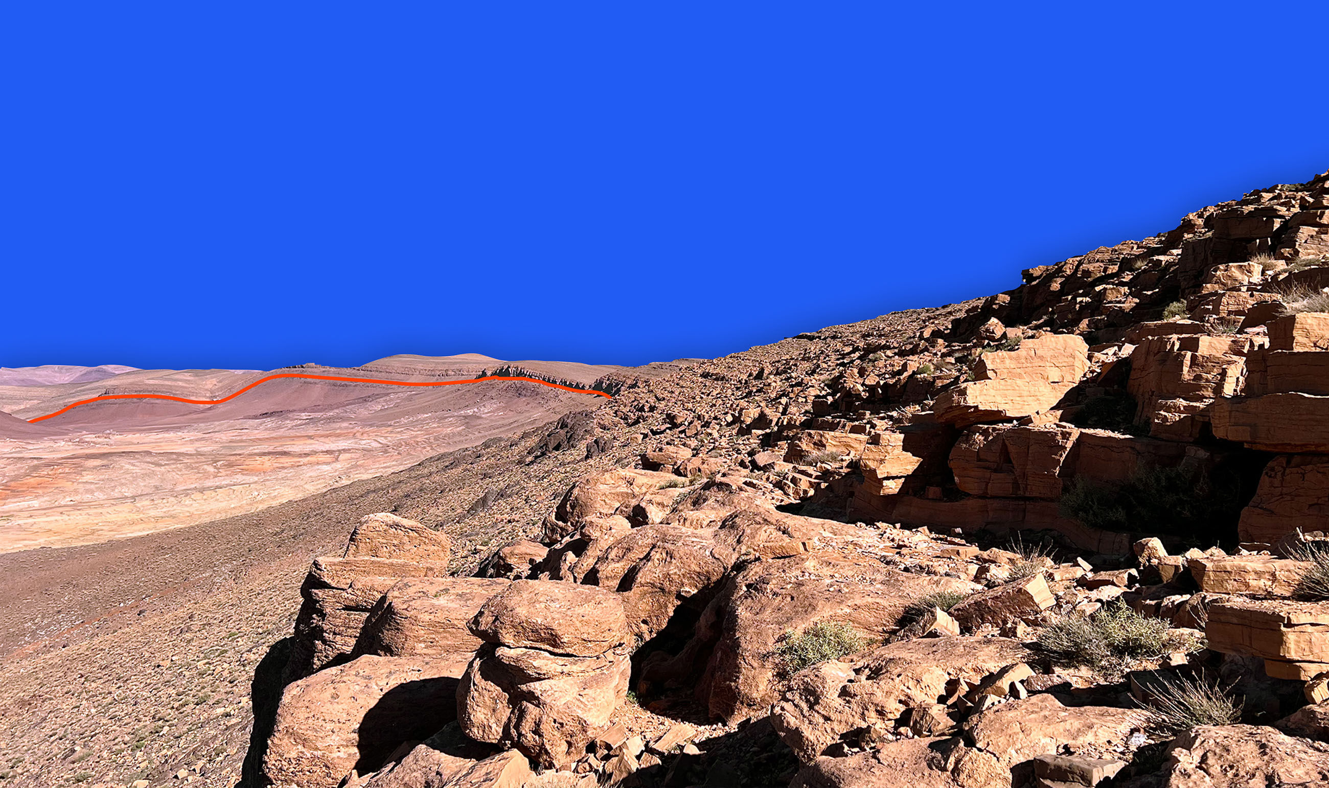
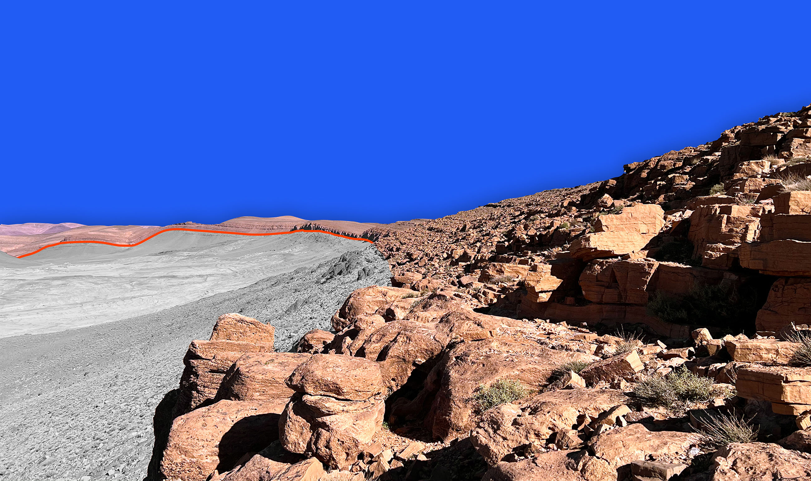
Natural Long Section
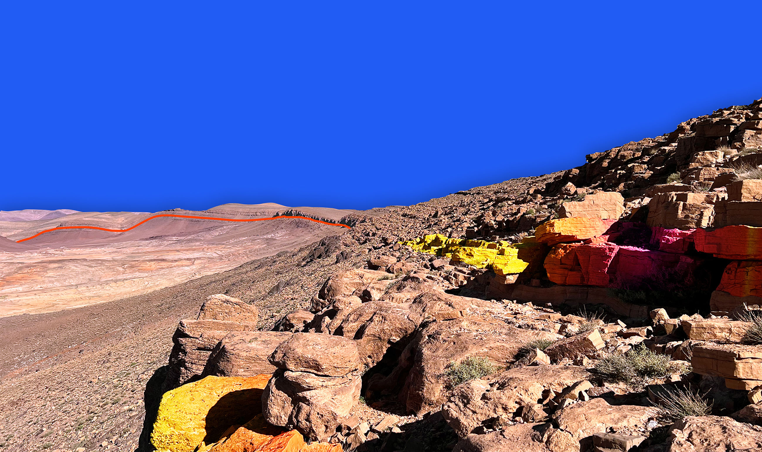
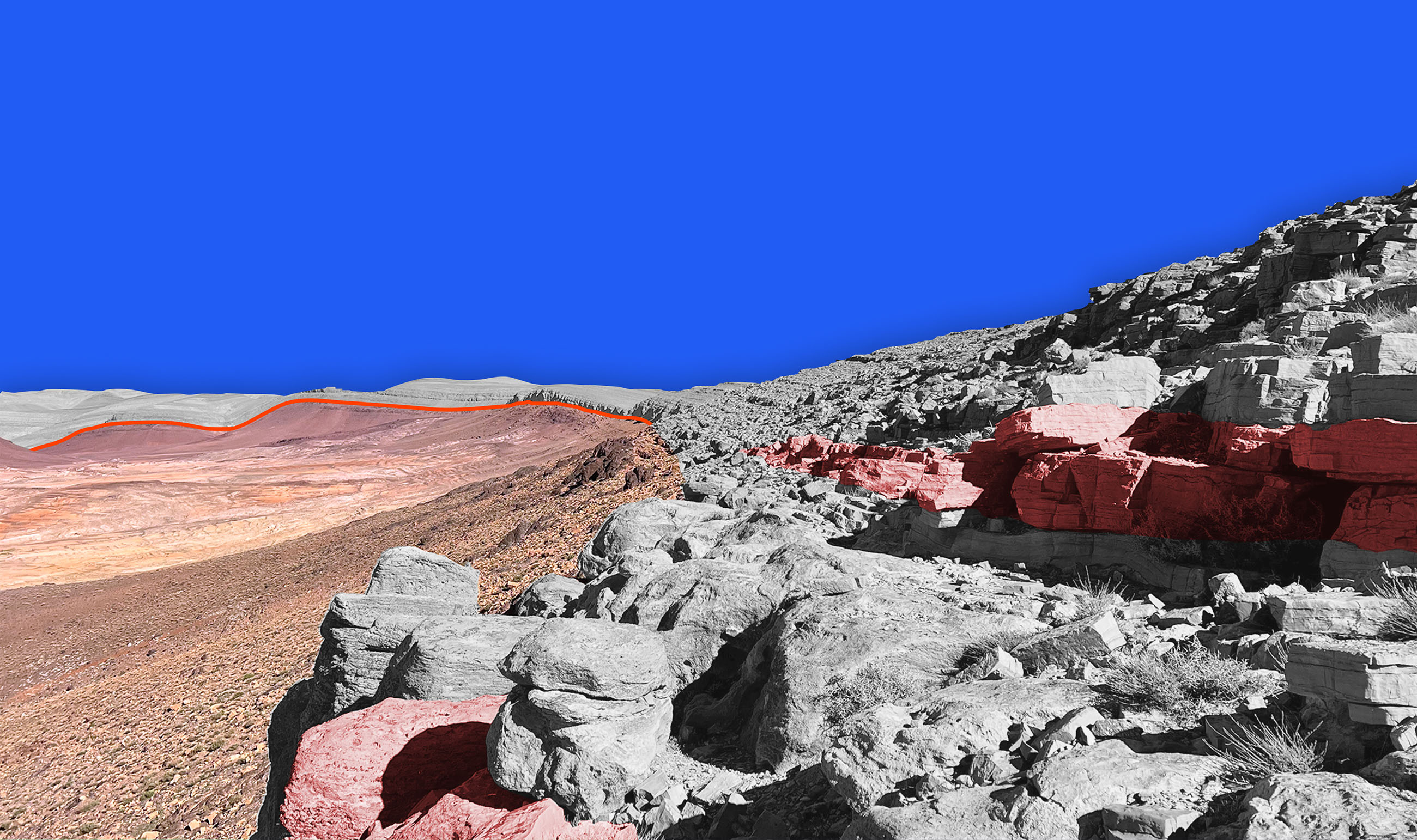
Across the Agadir Melloul project, on its eastern and western flanks, sedimentary copper mineralisation is exposed along escarpments, old river valleys and road cuts over approximately 12km of strike. There are also numerous copper-silver mineralised quartz veins and silicified shear zone structures.
Several years of drill targets
The sedimentary copper exposures ensure multiple near surface ‘walk-up’ drill targets for future low-cost drilling and a strong expectation that the Agadir-Melloul mineral resource will grow over time.
Growing land package
The Agadir Melloul project area is also expanding, primarily through strategic acquisitions. The company is now in a strong position where it dominates the district with approximately 65km2 combined of exploration permits (Permis de Recherche) and mining licenses.
Igneous and deeper targets
The exciting discovery of what appears to be primary igneous copper-silver mineralisation at Zone 2, opens up blue sky potential of an igneous copper discovery.
Strike extension
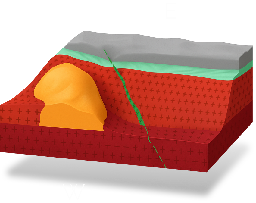
Mineralisation is typically found at the contact zone where the basement and overlying sedimentary rocks meet.
At Zones 1 to 4, it is possible to follow oxide and sulphide sedimentary copper mineralisation for several kilometres. Cu-Ag is also seen in shear structures, igneous and volcanic rocks – most notably rhyolite at Zone 2.
Proterozoic basement
The basement in the Anti-Atlas consists mainly of Proterozoic aged rocks. Spanning the Paleo (P1), Meso (P2) and Neo (P3) Proterozoic eras from 2.0 billion to 541 million years ago.
At Agadir Melloul the basement was initially not of major interest, however in 2025 drilling discovered a copper-silver mineralised rhyolite, opening up the basement and igneous copper mineralisation as an important new target.
Contact mineralisation
Mineralisation is related to the contact between basement and sedimentary rocks, a permeable pathway. Although in some cases mineralised units are ‘perched’ above the contact.
The leading theory is that mineralising fluids carrying magnesium, copper and silver flowed along this permeable boundary and migrated upwards into the overlying sediments. As the fluids hit a more alkaline environment, copper and silver was deposited, and magnesium transformed limestone into dolomite.
Early Cambrian rocks
The target rocks were deposited during a relatively short 10 million year period that spans the Precambrian – Cambrian geological boundary from circa 545 to 535 mya. These transition rocks are known locally as Infracambrian-aged “Série de Base” (Basal Series).
Following sedimentary deposition, the initial copper mineralisation likely occurred over a 10 to 15 million year period, while the sediments were still unlithified and porous to mineralising fluids.
Current Land Package
The current project area consists of 65 km2 of exploration permits and a mining license, with over 12km of outcropping mineralised strike across the various properties. This land package is growing rapidly as we build a dominant position in this copper district.
First area drilled – Zone 1 North
The maiden MRE, due to be published in 2026, is from a small part of the project, in an area named Zone 1 North and highlighted in the map below.

Carbonates
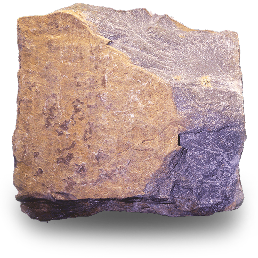
This mineralised Tamjout dolomite sample is the main target at Zone 1 North, and also found across the whole project area. It is a biochemical carbonate in the Adoudou Formation which sits unconformably on top of Proterozoic basement rocks.
Conglomerates
6km east north east of Zone 1 North is an area known as Zone 4. Here there is a 20m + outcrop of classic Tizert-style stratigraphy, a transgressive sequence that includes the Conglomérat de Base, the Petit Calcaire (little limestone), and the overlying Tamjout Dolomites.
The Tizert-style succession at Zone 4 features the thickest interval of mineralised outcrop at Agadir Melloul.
SEDIMENTARY COPPER
Agadir Melloul is believed to sit within the family of sediment hosted copper (SHC) deposits. Globally, the largest SHC deposits are the Kupferschiefer and Central African Copperbelt in the DRC and Zambia. There is also (a) the Kalahari Belt (b) Black Butte (c) Mount Isa (d) Udokan; and (e) Paterson Province.
OTHER STYLES OF MINERALISATION
At Agadir Melloul there are at least two other important deposit types, and both have potential to add meaningful tonnes and grade.
Rhyolite – a potentially large igneous target
During Q3 2025 a mineralised rhyolite was discovered in drill hole BHR01 containing copper, silver and lesser gold.
Shear zone and vein type
There are multiple mineralised vein type structures at Agadir Melloul. Some are quartz veins, others are wider silicified shear zones, typically mineralised with both copper and silver.
Key